
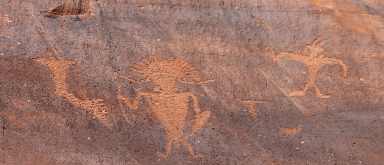
We drove up Potash Road Highway (State Route 279), stopping along to way to take in the sights. Petroglyphs were right off the main road, high up on the rock walls. Drawings were carved into the desert varnish:


 Several more miles up the road we stopped to check out the dinosaur tracks. The tracks were made by Therapods (three-toed predator dinosaurs that walked on two legs) 190 million years ago!


After about 17 miles, we passed by the Moab Salt Company, where the paved road ended. We drove through the Salt Company’s dirt road for about 5 more miles until we came back out on BLM land. We saw amazing salt-soaked land (in some places it looked like icicles!) and extraordinary blue evaporation ponds used to process the salt.
As we continued on the dirt trail, we hit several tough patches… we worried about getting stuck a few times, but put our faith in the Subaru and continued on! We must have missed the signs warning of steep, narrow and rough roads, encouraging only 4 x 4 and high clearance vehicles proceed!
 We wound our way through a very rough path. The road transitioned from red dirt and patches of sand to jagged and rocky slickrock, where we proceeded at barely a crawl. The road was very narrow, uneven and covered with large rocks and boulders… we worried we would get high-centered or flatten the tires with the sharp rocks or flip over, or who knows what!
At one point, we thought we should turn around, but we had come so far we decided to keep going. We stopped a truck coming from the opposite direction to find out how much farther... he told us we were not too far and our car would be fine. His wife looked pale from the trip, which wasn't very reassuring. He tried to make her feel better by saying, "see honey, they are doing it in a Subaru!" It was scary ride!!
 About 8 miles in, as we turned a corner coming down hill, we stopped in disbelief as we could see 1500 feel straight down the cliff to the Colorado River below. It was an amazing sight that literally took our breath away. This view was worth all the worry of the drive to get there. Not too far past this initial sighting of the river, we came to what is known as “Thelma and Louise Point.” Where the dramatic ending to the movie occurred and Thelma and Louise drove their 1966 Thunderbird into the Colorado River.


We continued on, and the road became more treacherous. At one point, I thought there was no way we could continue on. Carolyn insisted we had come too far to turn back. So she got out of the car and guided me up the rocky path, pointing out where to put my tires. As we continued on we came to many sketchy bits, but we just kept going! Along the way, we passed several groups of Jeeps out for Jeep Week – many looked at us in amazement – us in our Subaru braving the rocky roads.


We made our way out of the canyon – the winding switchback road took us up 1500 feet to the canyon rim above, and back safe and sound on pavement again!! In all, we were on the off-road trail for 30 miles, ending up inside Canyonlands National Park. It took us about 3 hours to get all the way through. It was an amazing trip…
This is the first time we saw the warning signs, AT THE END OF THE 30 MILE ROAD:


We are glad to have made it… and the good old Subaru is still in one piece! No dents, no dings, and no flat tires!!

No comments:
Post a Comment